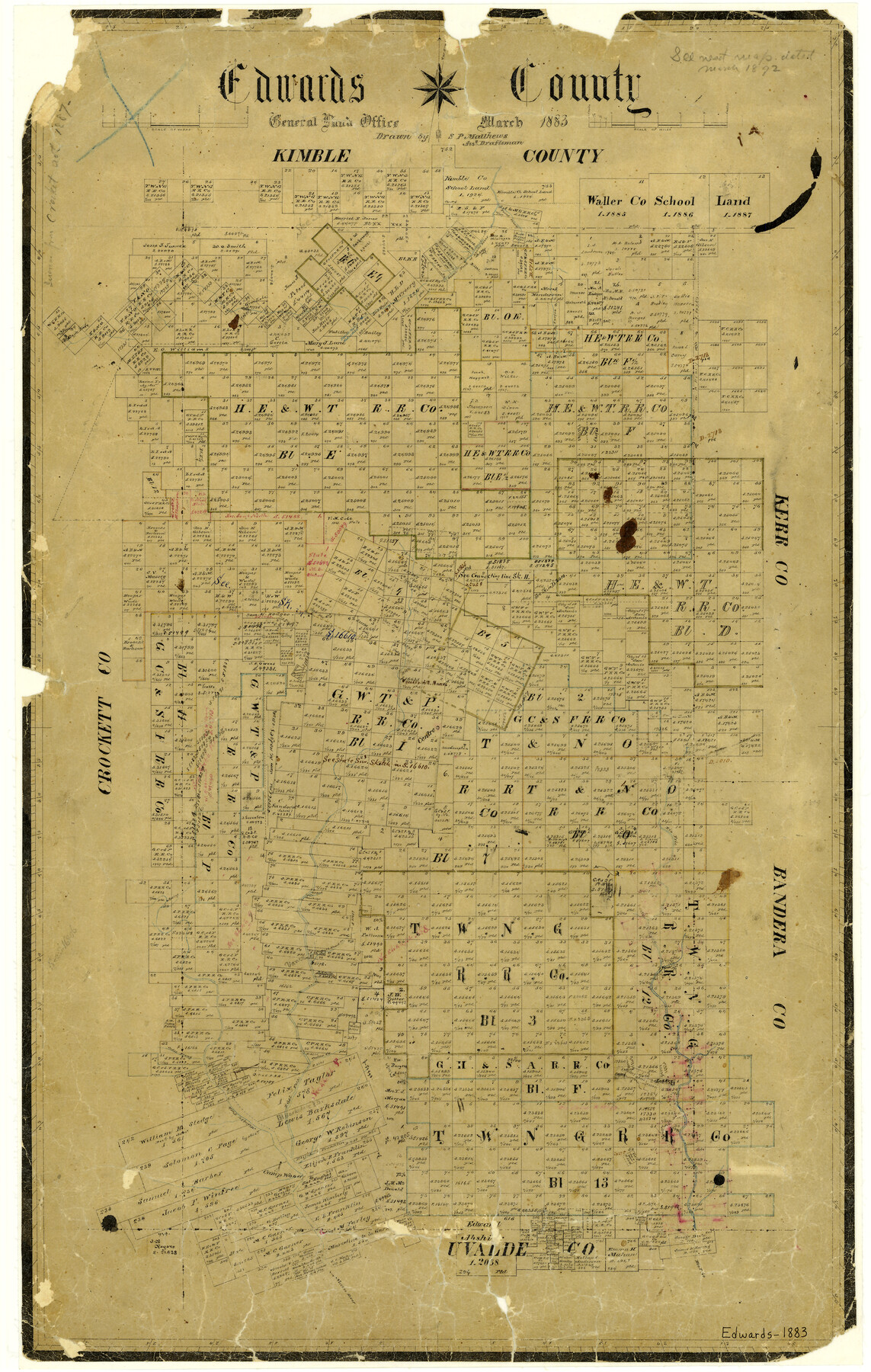
1883 (Creation Date) Map features South Fork of Llano River, Paint Creek, Green Lake, McKinzie [sic] Lake, Head Springs of East Nueces River, Rio Frio, Bull Head Creek & more.
Texas General Land Office (Publisher)
Sam. P. Matthews (Draftsman)
Height x Width
28.2 x 17.9 inches
71.6 x 45.5 cm
All maps are duplicate prints shipped from the Archives of the Texas General Land Office (GLO). GLO map duplication fees are in accordance with TEX. ADMIN. CODE ยง3.31(b)(5)(F) and proceeds obtained under the TEX. ADMIN. CODE for copying maps benefits Save Texas History. Any additional charges assessed by this website are at the sole discretion of TSHA. The GLO is not affiliated with TSHA and the availability of GLO Archive maps on this website does not constitute a partnership between the GLO and TSHA. Any and all claims, disputes, or remedies arising from a transaction on this website must be pursued through TSHA.
Reviews
There are no reviews yet.