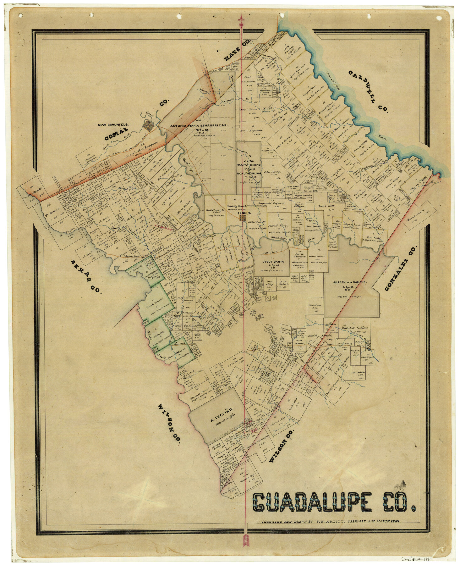
1869 (Creation Date) Map features Manchaca Creek, Guadalupe Creek, Highsmith’s Creek, San Geronimo, Comal River, Cleto Creek, Castleman’s Creek, Gonzales Road & more.
Texas General Land Office (Publisher)
F.H. Arlitt (Compiler)
F.H. Arlitt (Draftsman)
Height x Width
27.7 x 22.3 inches
70.4 x 56.6 cm
For more information about our relationship with GLO Maps, please see our GLO Maps Disclaimer.


Dianne Burgess (verified owner) –