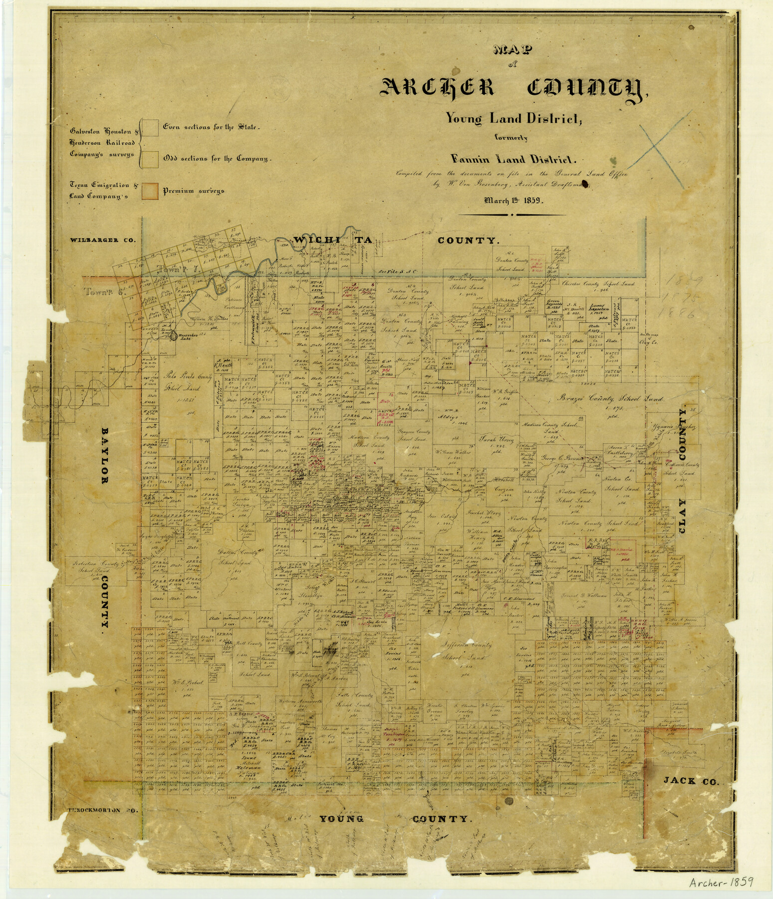
1859/3/1 (Creation Date) Map features Hollidays Creek, Horseshoe Lake, Beaver Creek, Little Wichita River & more.
Texas General Land Office (Publisher) W. von Rosenberg (Compiler)
Height x Width
25.2 x 21.6 inches
64.0 x 54.9 cm
For more information about our relationship with GLO Maps, please see our GLO Maps Disclaimer.


Reviews
There are no reviews yet