Map of Bexar County

(1 customer review)

$44.95

SKU: GLO-MAPS-3299 Category:

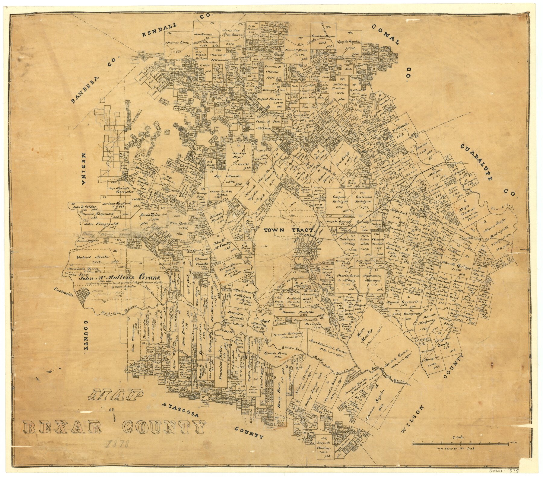
1878 (Creation Date) Map features Mission San Juan, Potranco Creek, Castroville, Saus Creek, Medina River, Medio Creek, Mission San Jose, Arroyo de la Piedra, San Jacinto Ditch, Mission Espada & more.

Texas General Land Office (Publisher)

Height x Width
23.5 x 26.6 inches
59.7 x 67.6 cm

All maps are duplicate prints shipped from the Archives of the Texas General Land Office (GLO). GLO map duplication fees are in accordance with TEX. ADMIN. CODE §3.31(b)(5)(F) and proceeds obtained under the TEX. ADMIN. CODE for copying maps benefits Save Texas History. Any additional charges assessed by this website are at the sole discretion of TSHA. The GLO is not affiliated with TSHA and the availability of GLO Archive maps on this website does not constitute a partnership between the GLO and TSHA. Any and all claims, disputes, or remedies arising from a transaction on this website must be pursued through TSHA.

1 review for Map of Bexar County

5.0
Based on 1 review
5 star
100
100%
4 star
0%
3 star
0%
2 star
0%
1 star
0%
  1. DN

    David Northrup (verified owner)

    I bought this map as a gift for a newly retired appraiser in Bexar County. He seemed to greatly appreciate it and the history it presents.
    Good packaging and quick delivery were great.

    (0) (0)

Only logged in customers who have purchased this product may leave a review.

You may also like…

legacy of texas logo tsha logo texas almanac logo
Shopping Cart