Map of Bosque County

(1 customer review)

$44.95

SKU: GLO-MAPS-3313 Category:

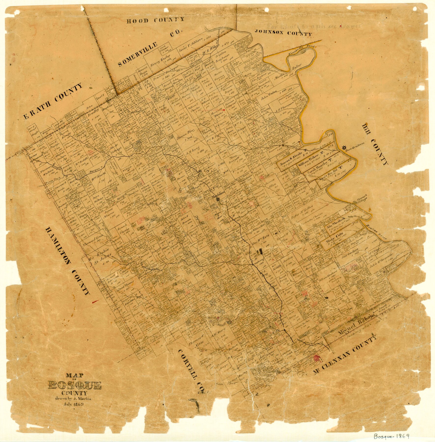
1869 (Creation Date) Map features Belton Road, Middle Bosque River, Hogg Creek, South Fork of Neels Creek, Neels Creek, Childres [sic] Creek, Turkeys Creek, Cary Creek, Brazos River & more.

Texas General Land Office (Publisher) Joseph Martin (Draftsman)

Height x Width
24.1 x 23.7 inches
61.2 x 60.2 cm

All maps are duplicate prints shipped from the Archives of the Texas General Land Office (GLO). GLO map duplication fees are in accordance with TEX. ADMIN. CODE §3.31(b)(5)(F) and proceeds obtained under the TEX. ADMIN. CODE for copying maps benefits Save Texas History. Any additional charges assessed by this website are at the sole discretion of TSHA. The GLO is not affiliated with TSHA and the availability of GLO Archive maps on this website does not constitute a partnership between the GLO and TSHA. Any and all claims, disputes, or remedies arising from a transaction on this website must be pursued through TSHA.

1 review for Map of Bosque County

5.0
Based on 1 review
5 star
100
100%
4 star
0%
3 star
0%
2 star
0%
1 star
0%
  1. Anonymous (verified owner)

    (0) (0)

Only logged in customers who have purchased this product may leave a review.

You may also like…

legacy of texas logo tsha logo texas almanac logo
Shopping Cart