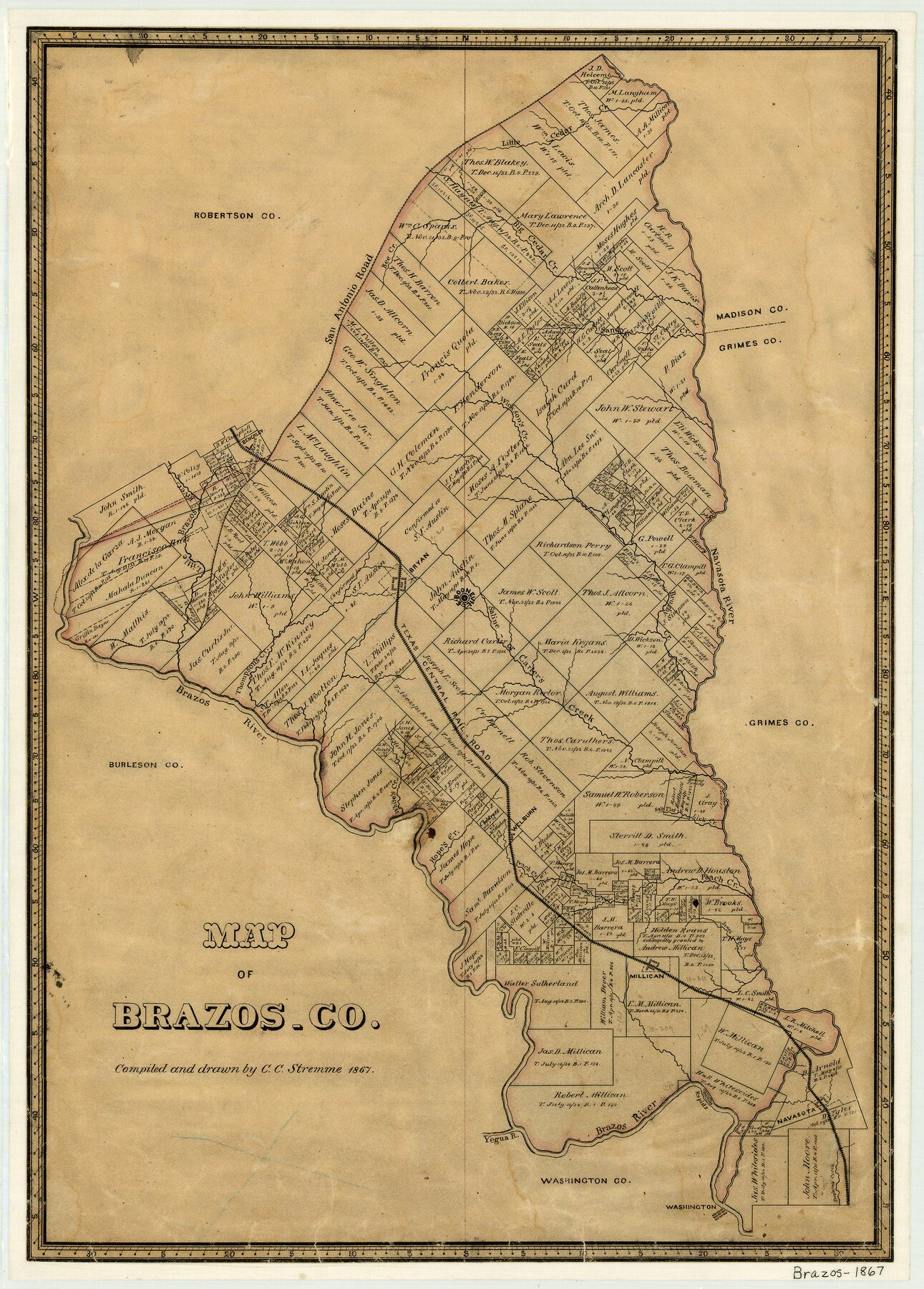
1867 (Creation Date) Map features TCRR, Lick Creek, Washington, Yegua River, Stephen’s Creek, Navasota, Jones Creek, Millican, Peach Creek, Salt Flat Creek & more.
Texas General Land Office (Publisher)
C.C. Stremme (Draftsman)
Height x Width
23.4 x 16.8 inches
59.4 x 42.7 cm
For more information about our relationship with GLO Maps, please see our GLO Maps Disclaimer.


Reviews
There are no reviews yet