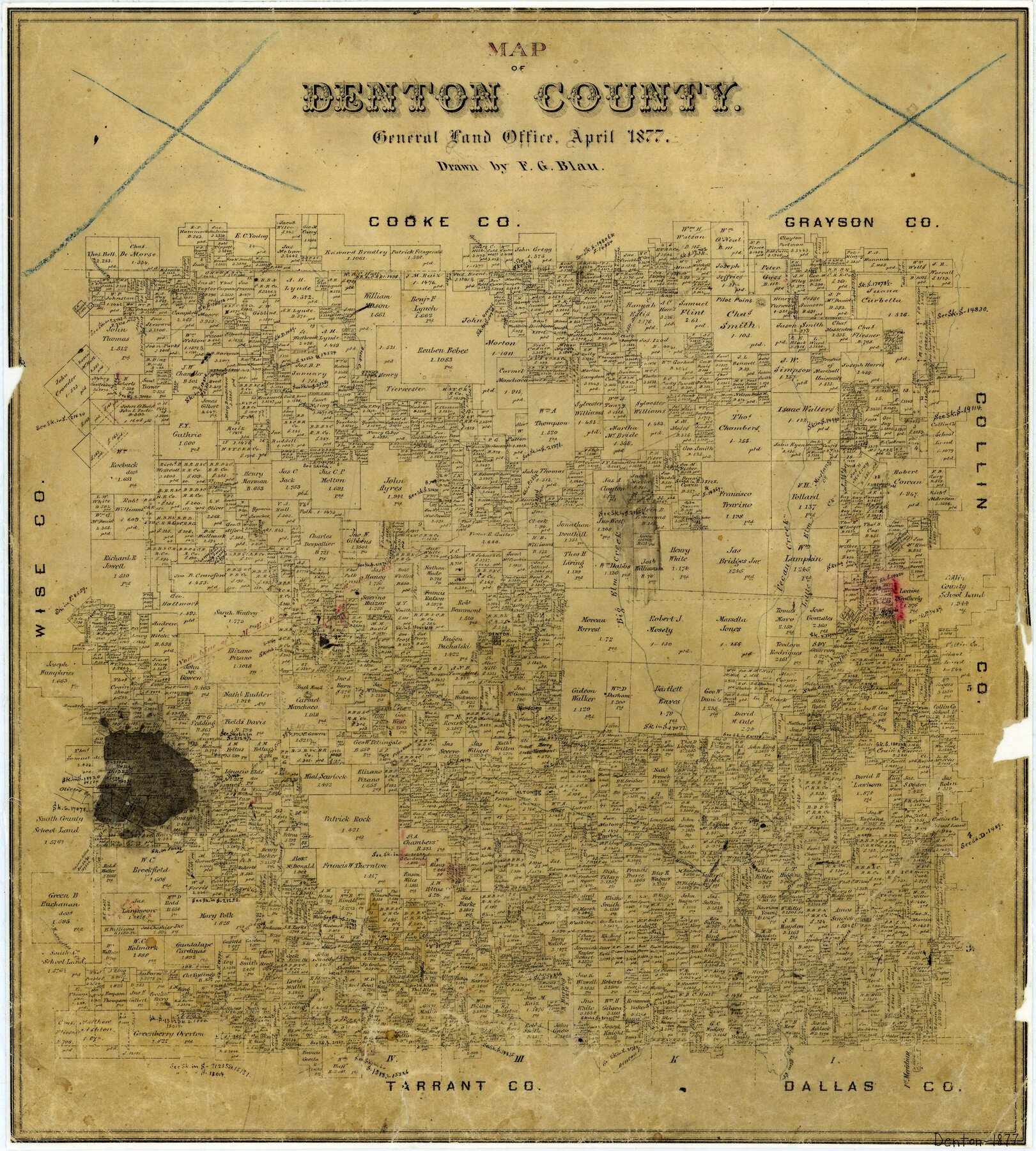
4/1877 (Creation Date) Map features Big Elm Creek, Oliver’s Creek, Brooks Creek, Henrietta’s Creek, Elizabeth’s Creek, Indian Creek, Stewart Creek, Hickory Creek & more.
Texas General Land Office (Publisher)
F.G. Blau (Draftsman)
Height x Width
20.7 x 18.6 inches
52.6 x 47.2 cm
For more information about our relationship with GLO Maps, please see our GLO Maps Disclaimer.


Reviews
There are no reviews yet