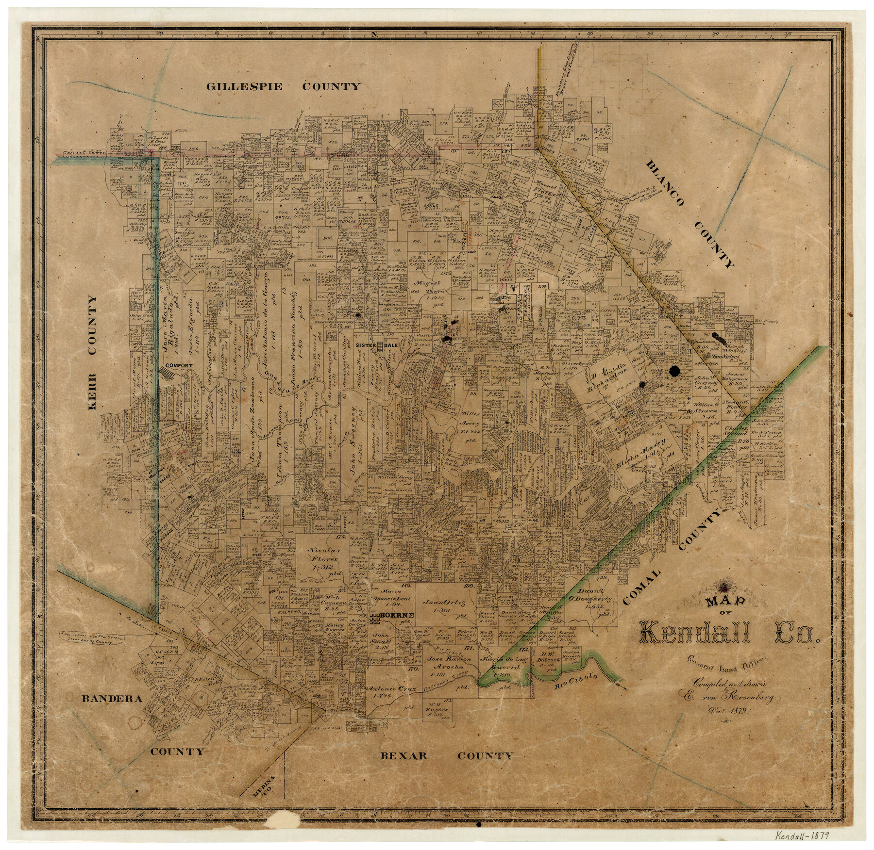
12/1879 (Creation Date) Map features Boerne, Twin Brothers, West Fork of Joshua’s Creek, Violet Creek, East Fork of Joshua’s Creek, Wasp Creek, Spring Creek, Curry’s Creek, Simmon’s Creek & more.
Texas General Land Office (Publisher)
E. von Rosenberg (Draftsman)
E. von Rosenberg (Compiler)
Height x Width
20.4 x 20.8 inches
51.8 x 52.8 cm
For more information about our relationship with GLO Maps, please see our GLO Maps Disclaimer.


Reviews
There are no reviews yet