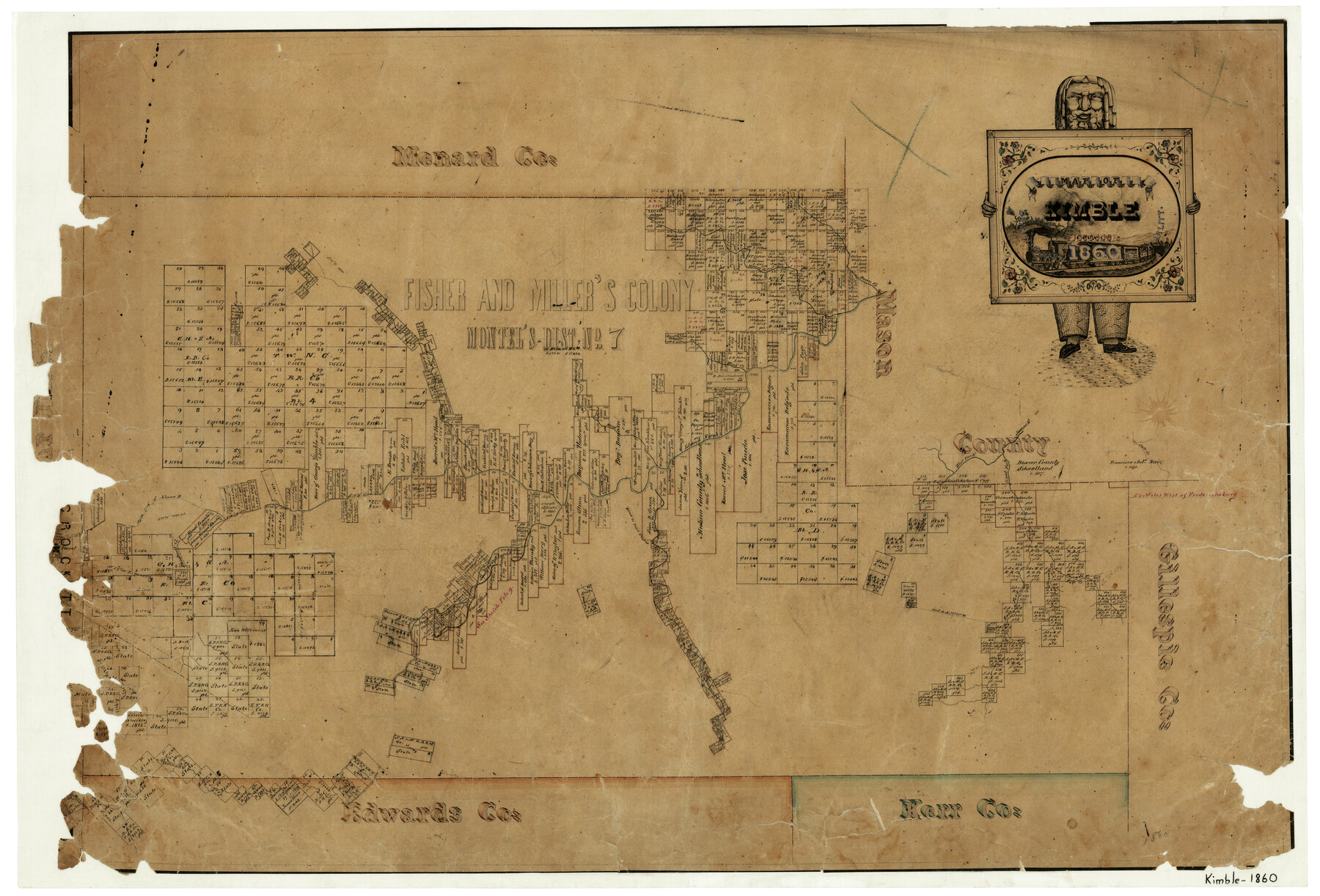
1860 (Creation Date) Map features Salt Creek, South Llano River, Williamson Creek, North Fork of Llano River, Chestnut Creek, South Fork of Llano River, Elm Fork [of Llano River], Road to Fort Terret & more.
Texas General Land Office (Publisher)
F.H. Arlitt (Draftsman)
Height x Width
20.7 x 30.5 inches
52.6 x 77.5 cm
For more information about our relationship with GLO Maps, please see our GLO Maps Disclaimer.


Reviews
There are no reviews yet