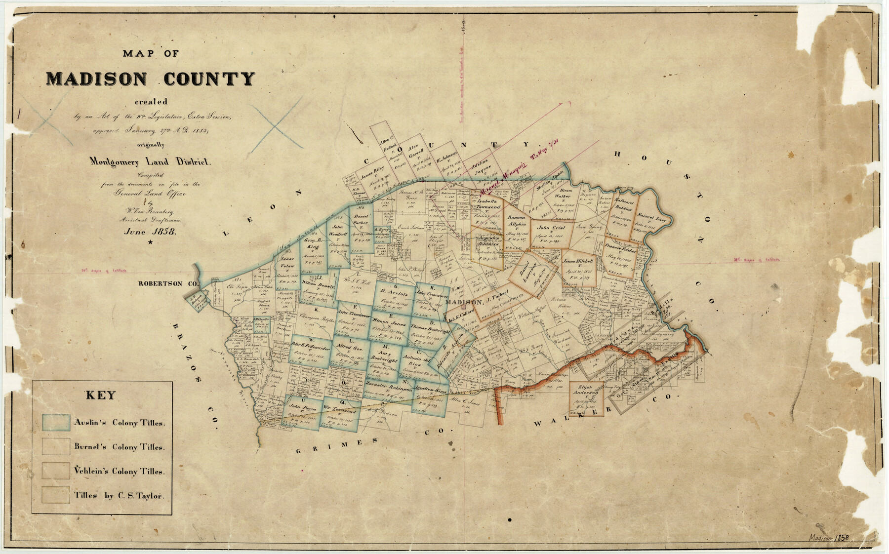
6/1858 (Creation Date) Map features Caney Creek, South Bidais Creek, Prewitt’s Creek, Navasoto [sic] River, Shephard’s Creek, Collard’s Creek, Bidais Creek, Pool’s Creek, Madison & more.
Texas General Land Office (Publisher)
W. von Rosenberg (Compiler)
Height x Width
19.8 x 31.7 inches
50.3 x 80.5 cm
For more information about our relationship with GLO Maps, please see our GLO Maps Disclaimer.


Reviews
There are no reviews yet