Map of Navarro County

$44.95

SKU: GLO-MAPS-3912 Category:

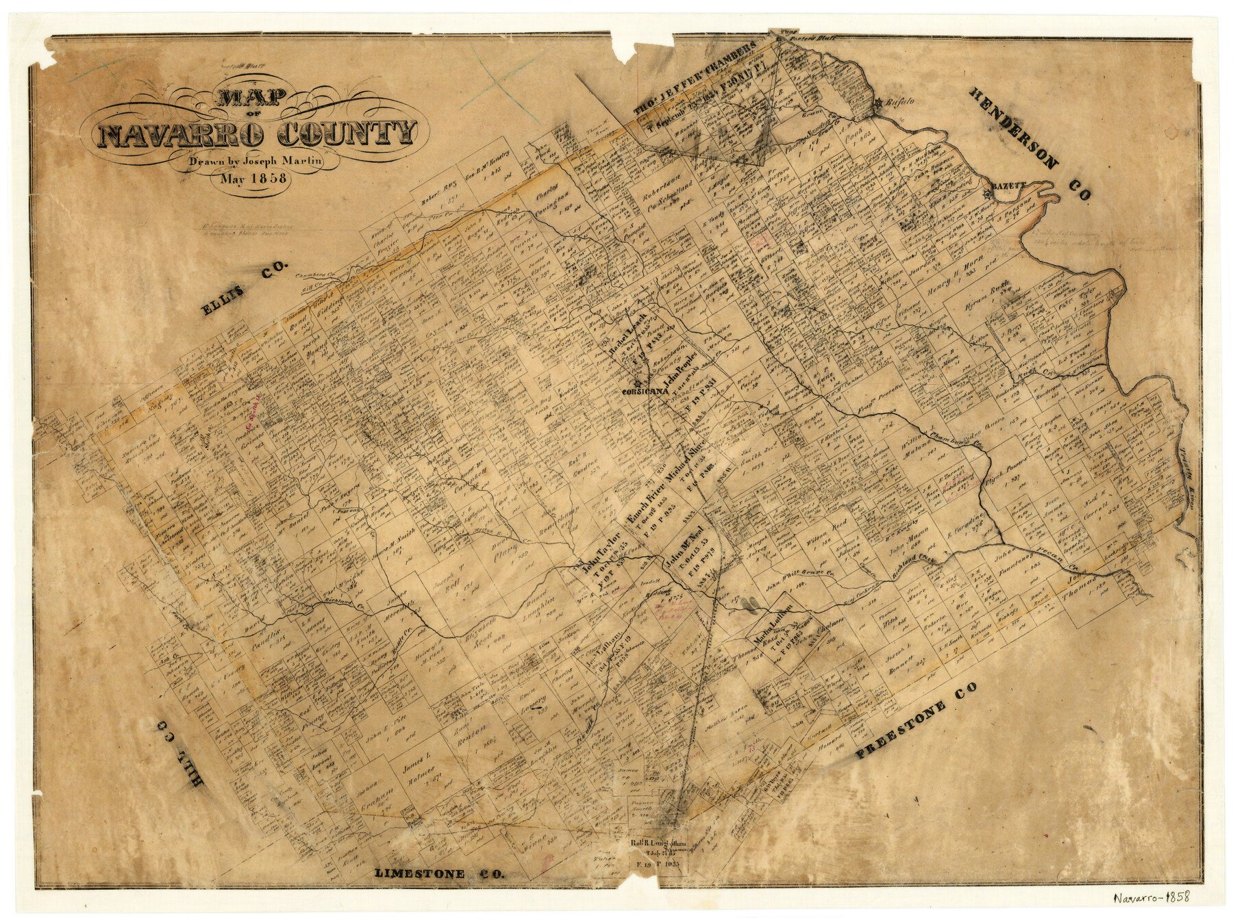
1858 (Creation Date) Map features Richland Creek, Melton B[ranch of Cottonwood Creek], Elm Creek, Grape Creek, Briar Creek, Corsicana, Porter’s Bluff, Taos, Pin Oak Creek & more.

Texas General Land Office (Publisher)
Joseph Martin (Draftsman)

Height x Width
19.3 x 25.8 inches
49.0 x 65.5 cm

All maps are duplicate prints shipped from the Archives of the Texas General Land Office (GLO). GLO map duplication fees are in accordance with TEX. ADMIN. CODE §3.31(b)(5)(F) and proceeds obtained under the TEX. ADMIN. CODE for copying maps benefits Save Texas History. Any additional charges assessed by this website are at the sole discretion of TSHA. The GLO is not affiliated with TSHA and the availability of GLO Archive maps on this website does not constitute a partnership between the GLO and TSHA. Any and all claims, disputes, or remedies arising from a transaction on this website must be pursued through TSHA.

Reviews

There are no reviews yet

Only logged in customers who have purchased this product may leave a review.

legacy of texas logo tsha logo texas almanac logo
Shopping Cart