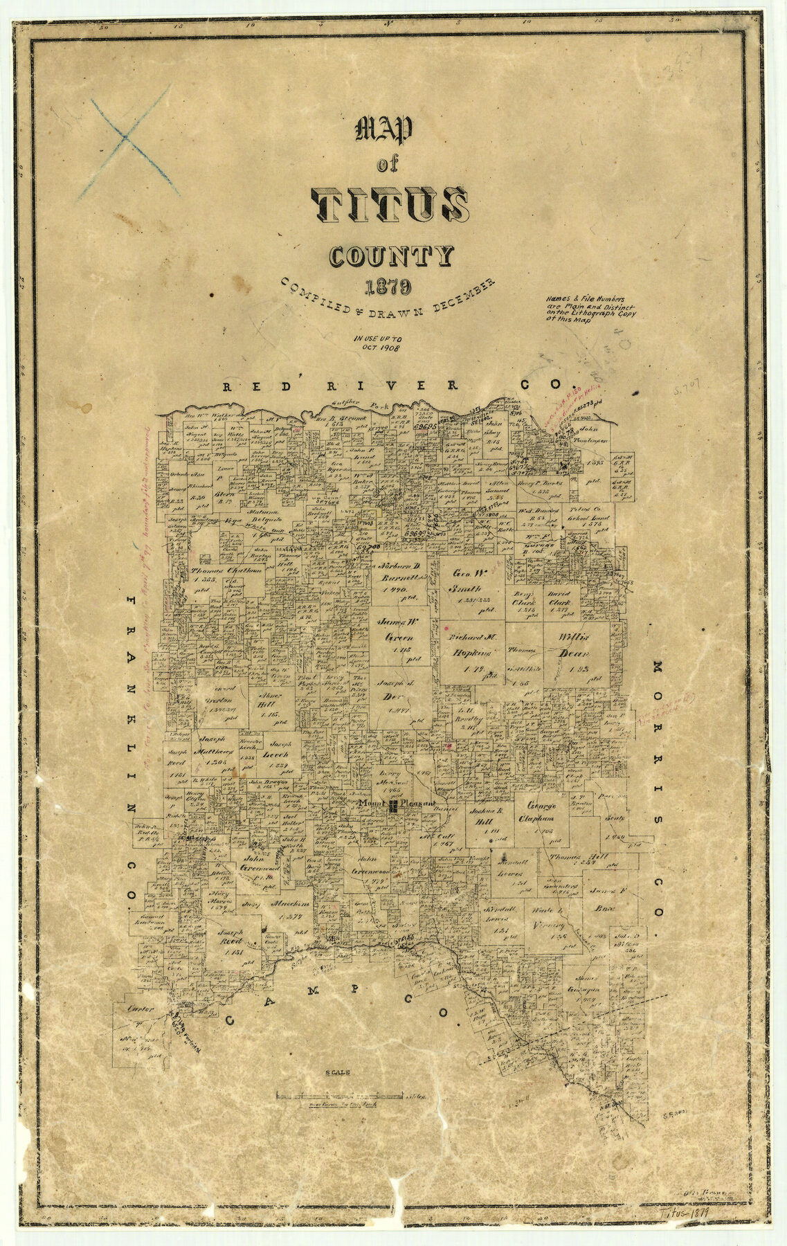
1879 (Creation Date) Map features Sulphur Fork of Red River, White Oak Creek, Horse Creek, Ripleys Creek, Harrys Creek, Mount Pleasant & more
Texas General Land Office (Publisher)
Otto Groos (Draftsman)
Otto Groos (Compiler)
Height x Width
23.4 x 14.8 inches
59.4 x 37.6 cm
For more information about our relationship with GLO Maps, please see our GLO Maps Disclaimer.


Reviews
There are no reviews yet