Map of Webb County

Rated 5.00 out of 5 based on 1 customer rating
(1 customer review)

$44.95

- +
SKU: GLO-MAPS-4128 Category:

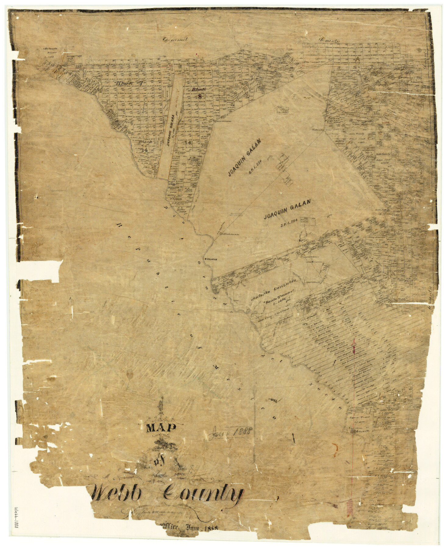
1888 (Creation Date) Map features Zacatoso Creek, A[rroyo] Pedernales, Road to Eagle Pass, Arroyo del Espada, San Isabel Creek, Baylor Pass, Fort McIntosh, Laredo & more.

Texas General Land Office (Publisher)

W.S. Porter (Draftsman)

Height x Width

33.6 x 27.7 inches

85.3 x 70.4 cm

For more information about our relationship with GLO Maps, please see our GLO Maps Disclaimer.

1 review for Map of Webb County

5.0
Based on 1 review
5 star
100
100%
4 star
0%
3 star
0%
2 star
0%
1 star
0%
  1. Rated 5 out of 5

    Charles Hallmark (verified owner)

    Great map, expensive

    (0) (0)

Only logged in customers who have purchased this product may leave a review.

You may also like…

legacy of texas logo tsha logo texas almanac logo
Shopping Cart