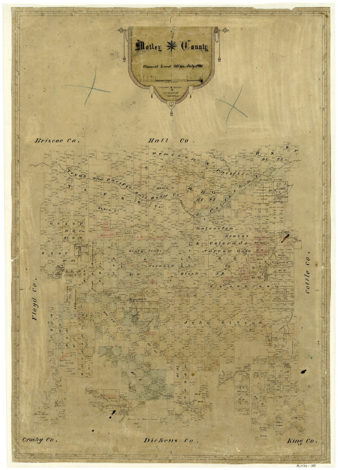
7/1881 (Creation Date) Map features Bill’s Branch [o South Fork of Pease River], Long Branch, Autumn Creek, Wichita River, Ballard Creek, Priest’s Spring,, Salt Branch, Dutchman’s Creek & more.
Texas General Land Office (Publisher)
Sam. P. Matthews (Draftsman)
Sam. P. Matthews (Compiler)
Height x Width
29.6 x 21.3 inches
75.2 x 54.1 cm
For more information about our relationship with GLO Maps, please see our GLO Maps Disclaimer.


Reviews
There are no reviews yet