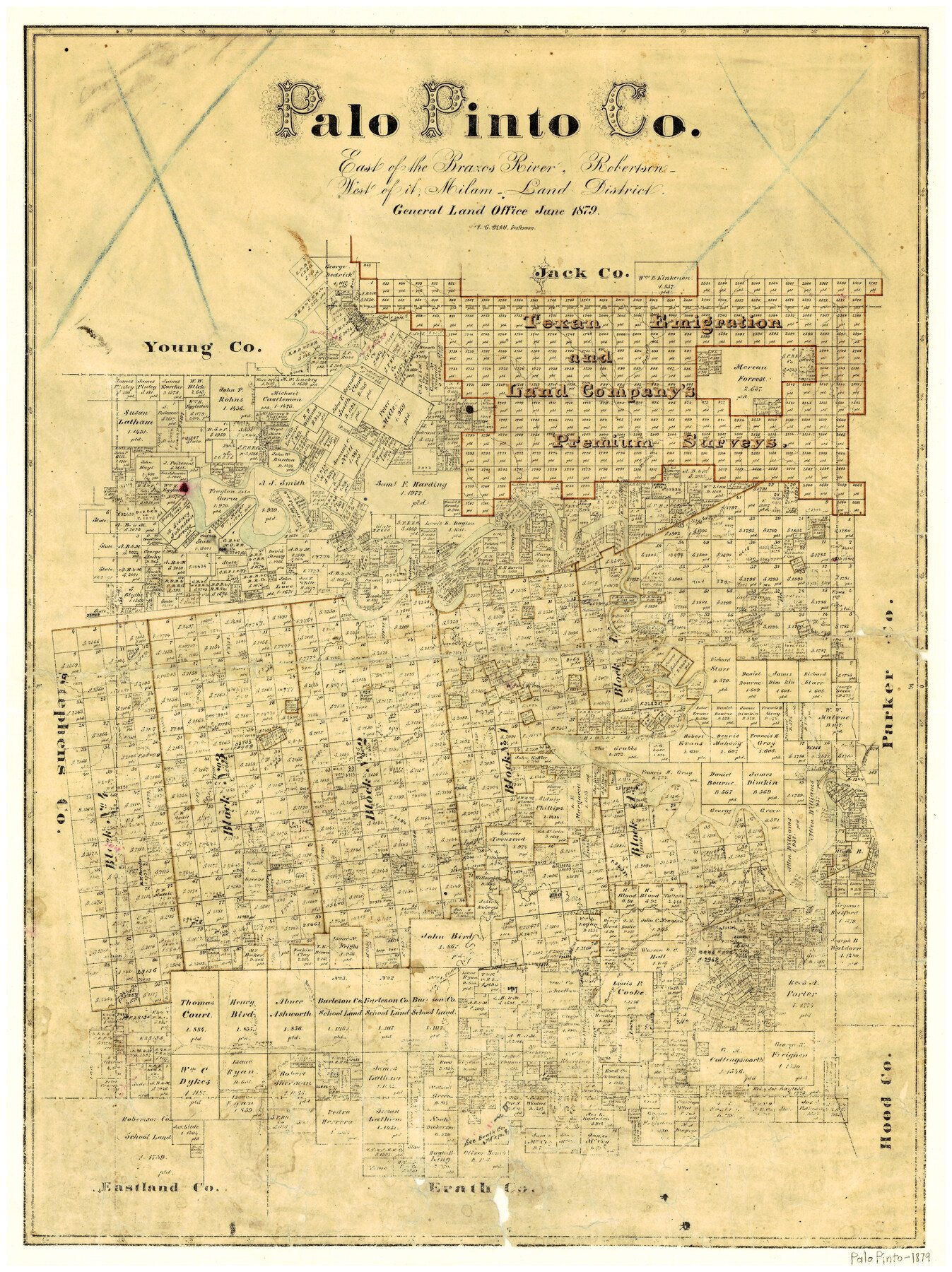
6/1879 (Creation Date) Map features Worser Creek, Strawn Creek, Keechi Creek, Cedar Bluff Creek, Boles Creek, Palo Pinto & Griffin Road, Walnut Creek & more.
Texas General Land Office (Publisher)
F.G. Blau (Draftsman)
F.G. Blau (Compiler)
Height x Width
24.8 x 18.4 inches
63.0 x 46.7 cm
For more information about our relationship with GLO Maps, please see our GLO Maps Disclaimer.


Reviews
There are no reviews yet