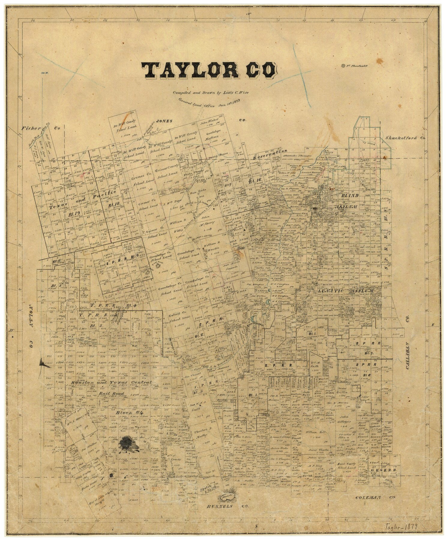
1879/1/18 (Creation Date) Map features East Peak, Cedar Creek, Road from Chadbourn to Phantom Hill, Road from San Antonio to Phantom Hill, Moro Mountain, West Fork of Bluff Creek, West Fork of Spring Creek, Jim Ned Creek & more.
Texas General Land Office (Publisher)
Louis C. Wise (Draftsman)
Louis C. Wise (Compiler)
Height x Width
24.2 x 19.9 inches
61.5 x 50.5 cm
For more information about our relationship with GLO Maps, please see our GLO Maps Disclaimer.


Reviews
There are no reviews yet