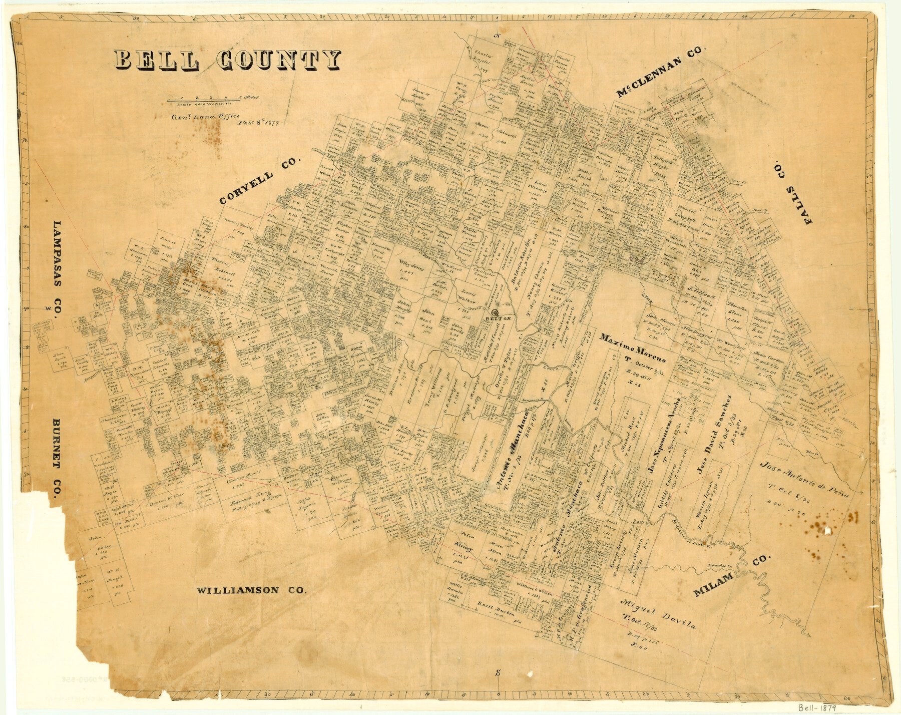
1879/2/8 (Creation Date) Map features Lampassas [sic] River, Elm Springs Creek, Indian Creek, Clear Creek, Trimmier Creek, Freeman Creek, Mitchell Creek, South Fork of Elm Creek, Donahoe Creek, St. Andreas River & more.
Texas General Land Office (Publisher)
Height x Width
23.6 x 29.7 inches
59.9 x 75.4 cm
Originally Montgomery Land District.
For more information about our relationship with GLO Maps, please see our GLO Maps Disclaimer.


David F. (verified owner) –