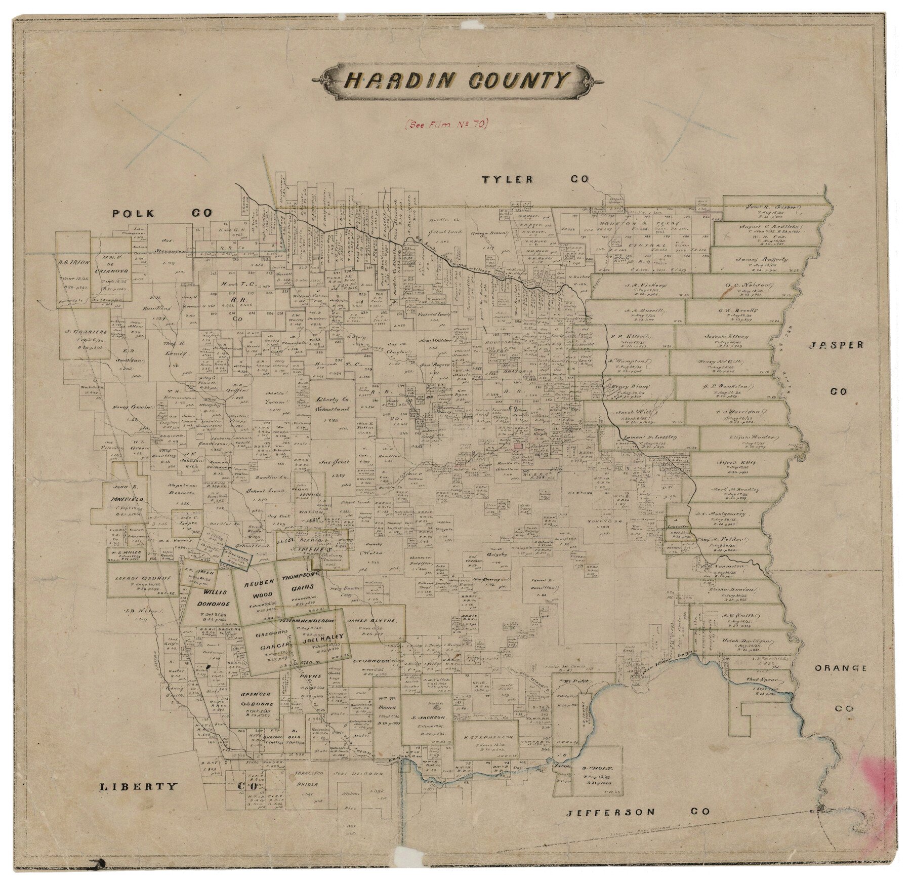
Map features Little Cypress Creek, Long Pine Bluff, Beaumont, Batiste’s Creek, Middle Fork of Pine Island Bayou, West Fork of Pine Island Bayou, Sour Lake & more.
Texas General Land Office (Publisher)
Height x Width
21.4 x 22.1 inches
54.4 x 56.1 cm
For more information about our relationship with GLO Maps, please see our GLO Maps Disclaimer.


Jerry Dollinger (verified owner) –
Too dark and hard to read; darker than online example. Delivery took way too long. Delivery status messaging was marginal; I had to call to find out status. I didn’t expect an Amazon experience, but was not properly prepared for what I got.