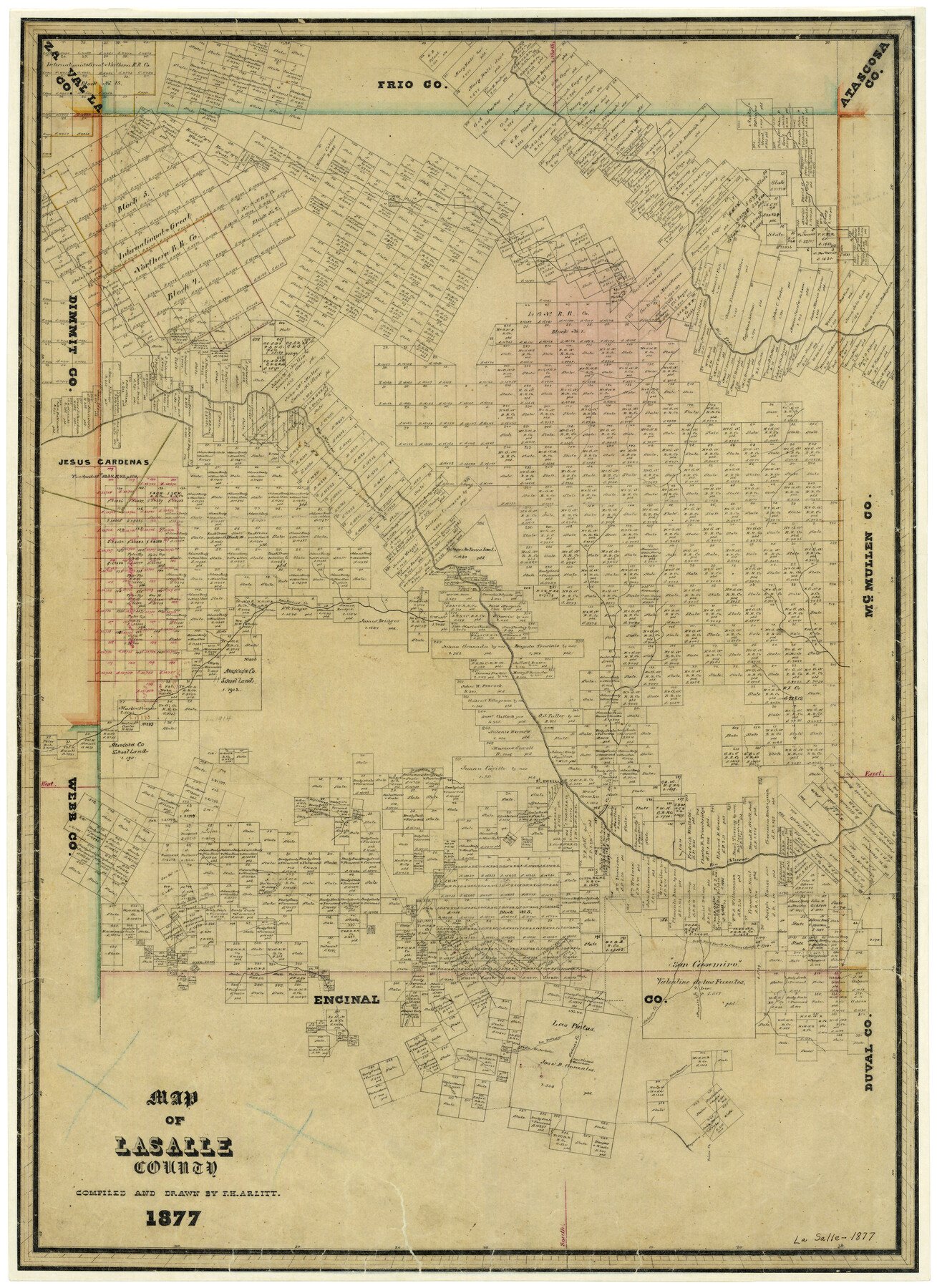
1877 (Creation Date) Map features Mayorera [Creek], Old Road, Cochino Creek, La Parida Creek, Salado Creek, Eagle Hill Creek, Alamito Creek, Tecolate Creek & more.
Texas General Land Office (Publisher)
F.H. Arlitt (Draftsman)
F.H. Arlitt (Compiler)
Height x Width
29.7 x 21.6 inches
75.4 x 54.9 cm
For more information about our relationship with GLO Maps, please see our GLO Maps Disclaimer.


Reviews
There are no reviews yet