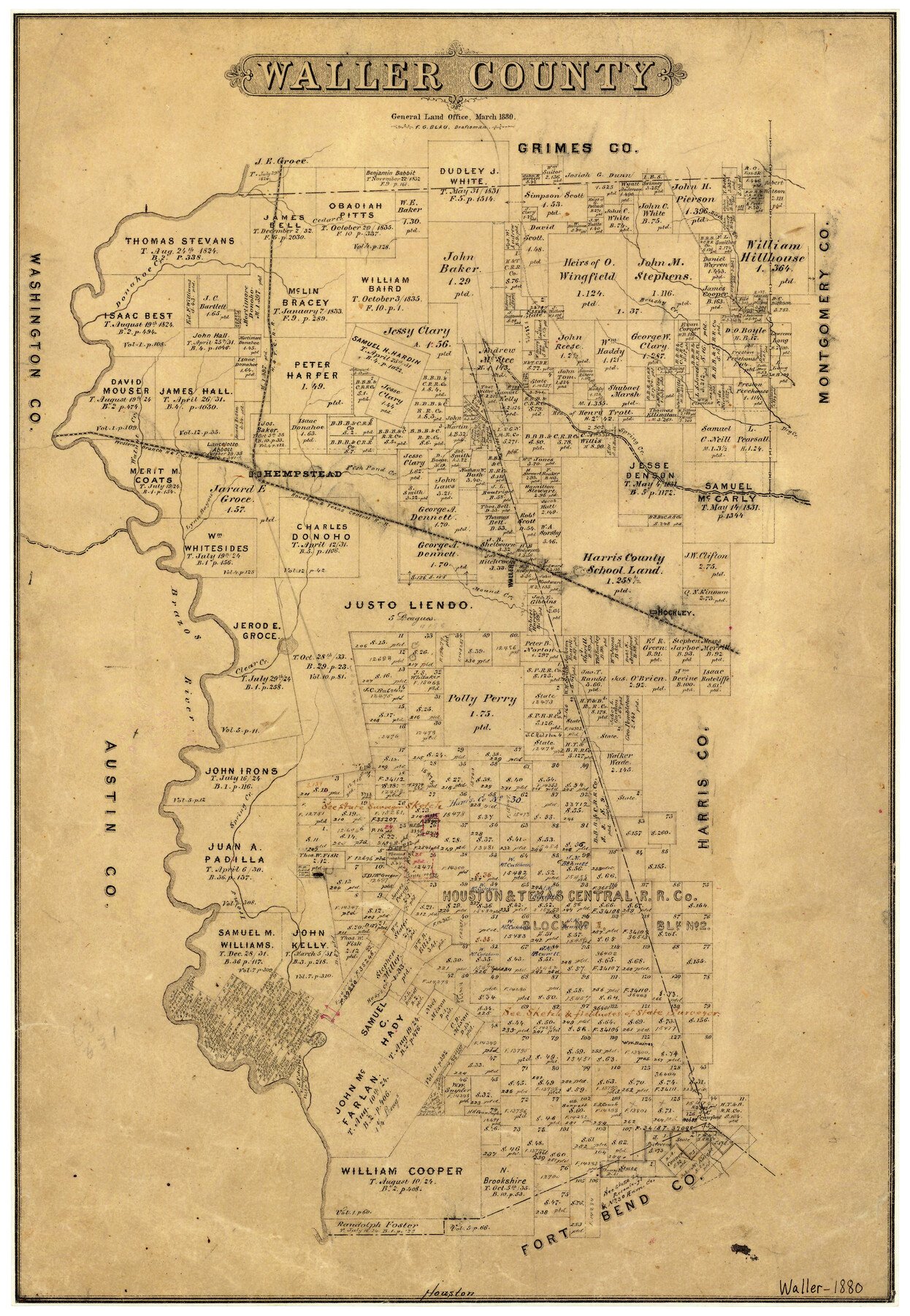
3/1880 (Creation Date) Map features Lynn Bayou, Hady’s Creek, Iron’s Creek, Besse’s [sic] Creek, Brazos River, Clear Creek, Hockley, Mound Creek & more.
Texas General Land Office (Publisher)
F.G. Blau (Compiler)
F.G. Blau (Draftsman)
Height x Width
20.4 x 14.5 inches
51.8 x 36.8 cm
For more information about our relationship with GLO Maps, please see our GLO Maps Disclaimer.


Reviews
There are no reviews yet