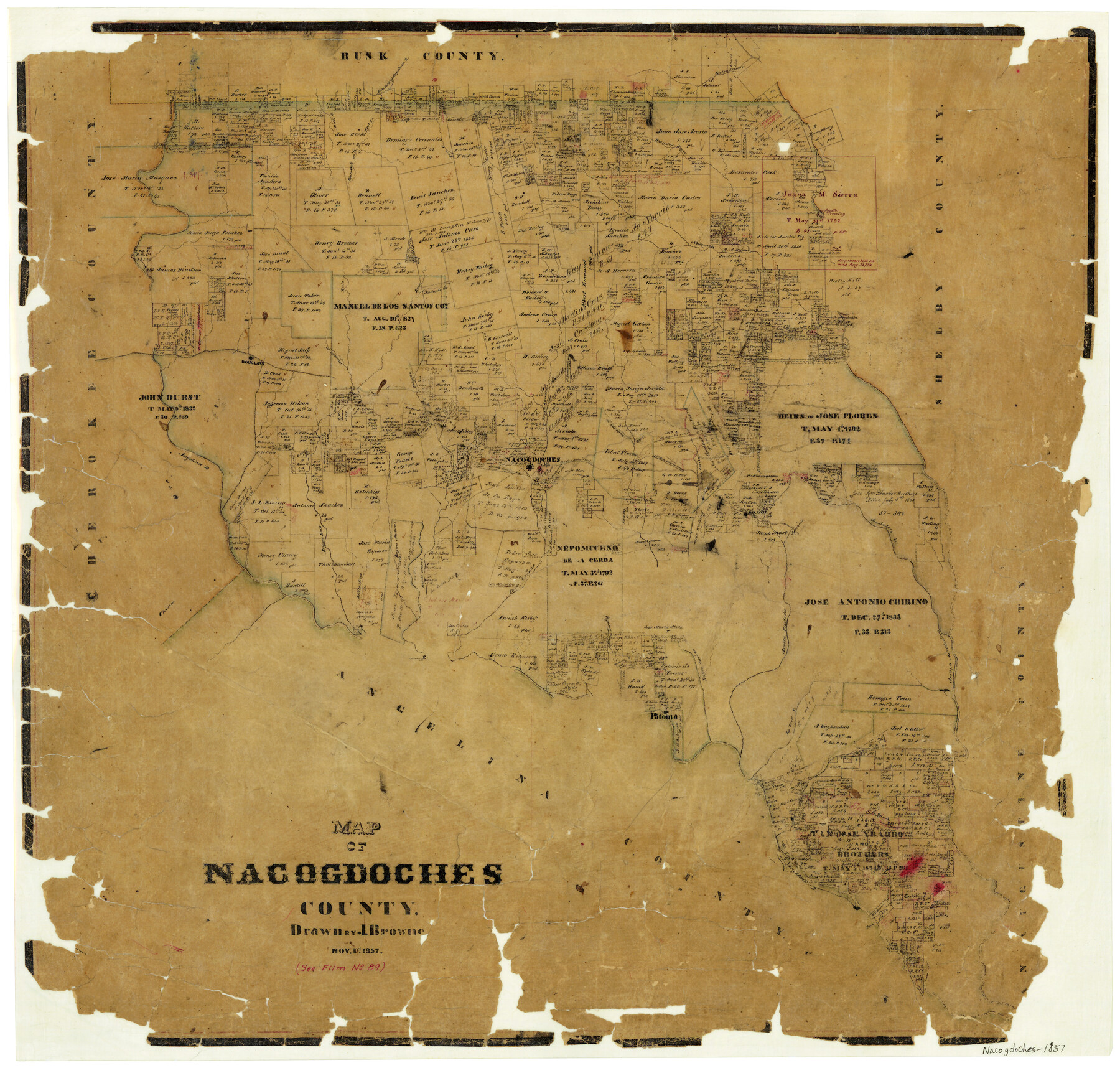
11/1/1857 (Creation Date) Map features Patonia, Amaladero Creek, Agallitas Creek, Aluzun Bayou, Little Loco [Bayou], Loco Bayou, Dorr Creek & more.
Texas General Land Office (Publisher)
J. Browne (Draftsman)
Height x Width
22.9 x 24.3 inches
58.2 x 61.7 cm
For more information about our relationship with GLO Maps, please see our GLO Maps Disclaimer.


Reviews
There are no reviews yet