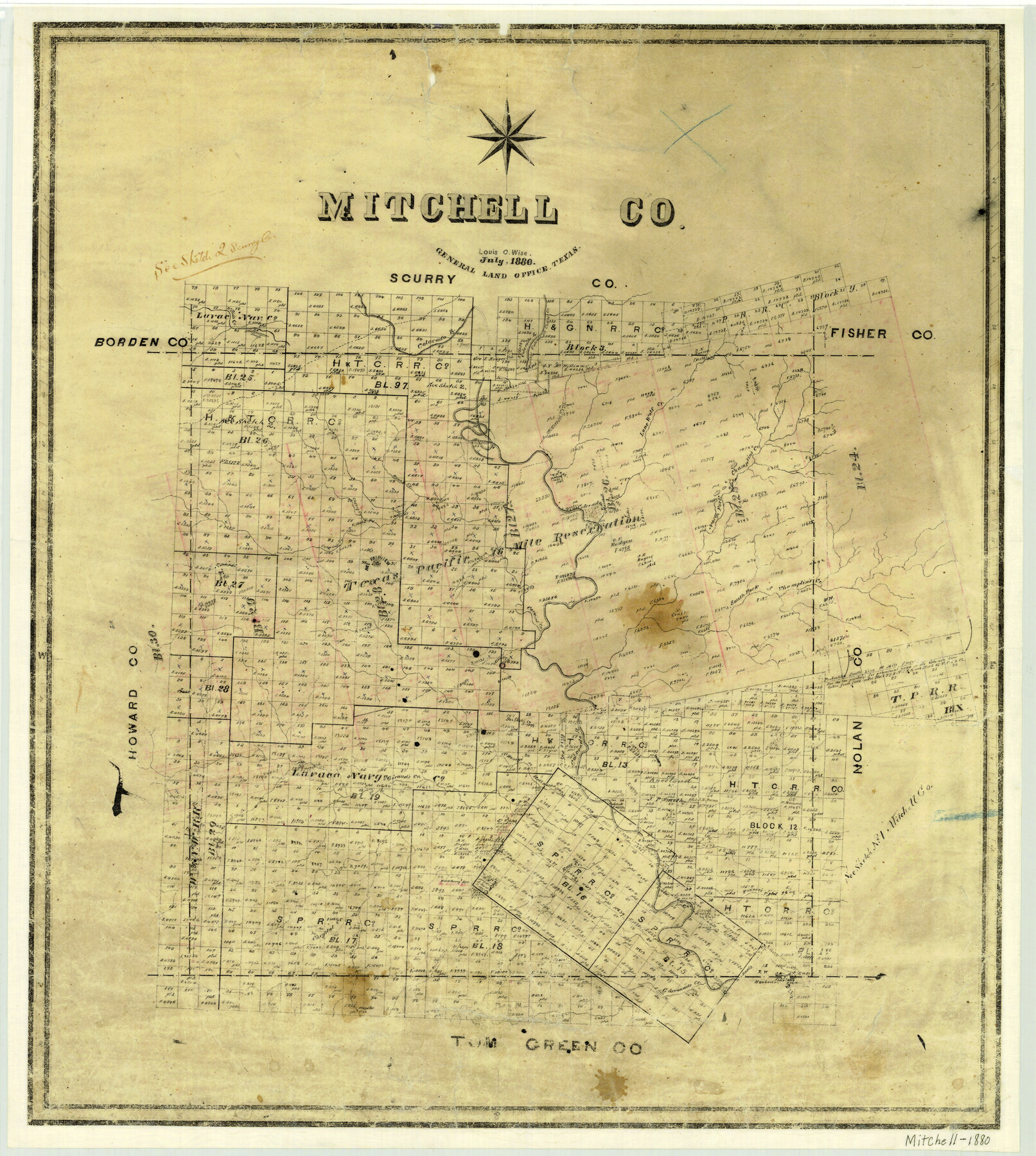
1880 (Creation Date) Map features North Fork of Champlin’s Creek, Gasconade Creek, Hackberry Creek, Renderbrook Creek, Chrystal Creek, Hackberry Spring, Ross Creek, Fannie’s Creek.
Texas General Land Office (Publisher)
Louis C. Wise (Compiler)
Louis C. Wise (Draftsman)
Height x Width
26.2 x 23.5 inches
66.5 x 59.7 cm
For more information about our relationship with GLO Maps, please see our GLO Maps Disclaimer.


Reviews
There are no reviews yet