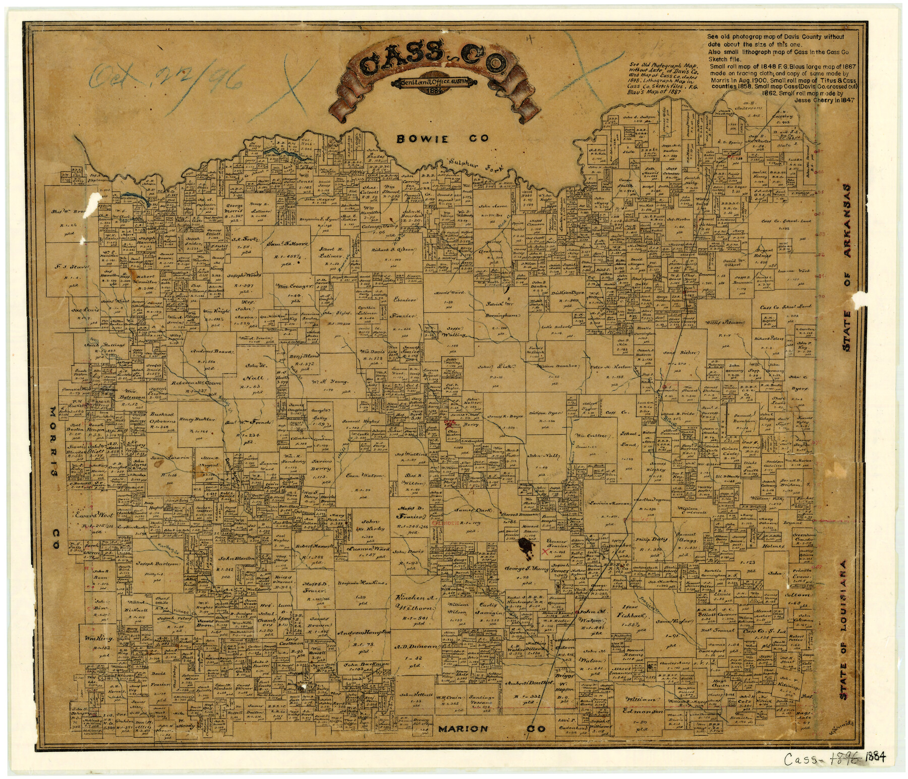
1884 (Creation Date) Map features Mill Creek,T&P, Kildare, Atlaillo, Hoxies, Lanark, Village Creek, Turkey Creek, Jims Bayou, Fraziers Creek & more.
Texas General Land Office (Publisher)
V. Schmidt (Draftsman)
Height x Width
17.3 x 20.2 inches
43.9 x 51.3 cm
For more information about our relationship with GLO Maps, please see our GLO Maps Disclaimer.


Reviews
There are no reviews yet