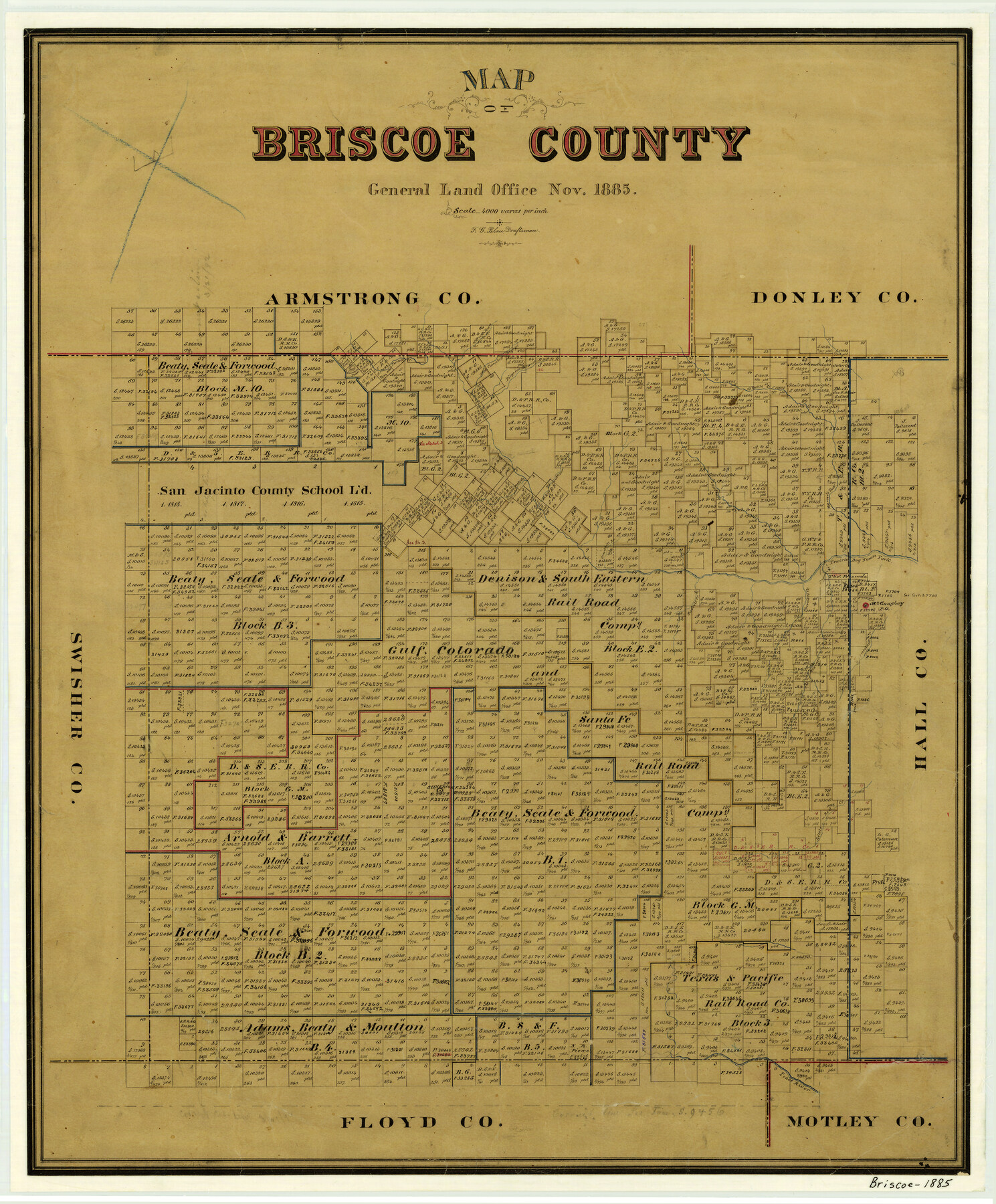
1885 (Creation Date) Map features Tule Creek, Pease River, Silverton, Little Red Creek, Mexican Creek, Antelope Creek, McGaughey Post Office, Prairie Dog Town Fork [of Red River], Cherokee Creek & more.
Texas General Land Office (Publisher)
F.G. Blau (Draftsman)
Height x Width
24.4 x 20.1 inches
62.0 x 51.1 cm
For more information about our relationship with GLO Maps, please see our GLO Maps Disclaimer.


Reviews
There are no reviews yet