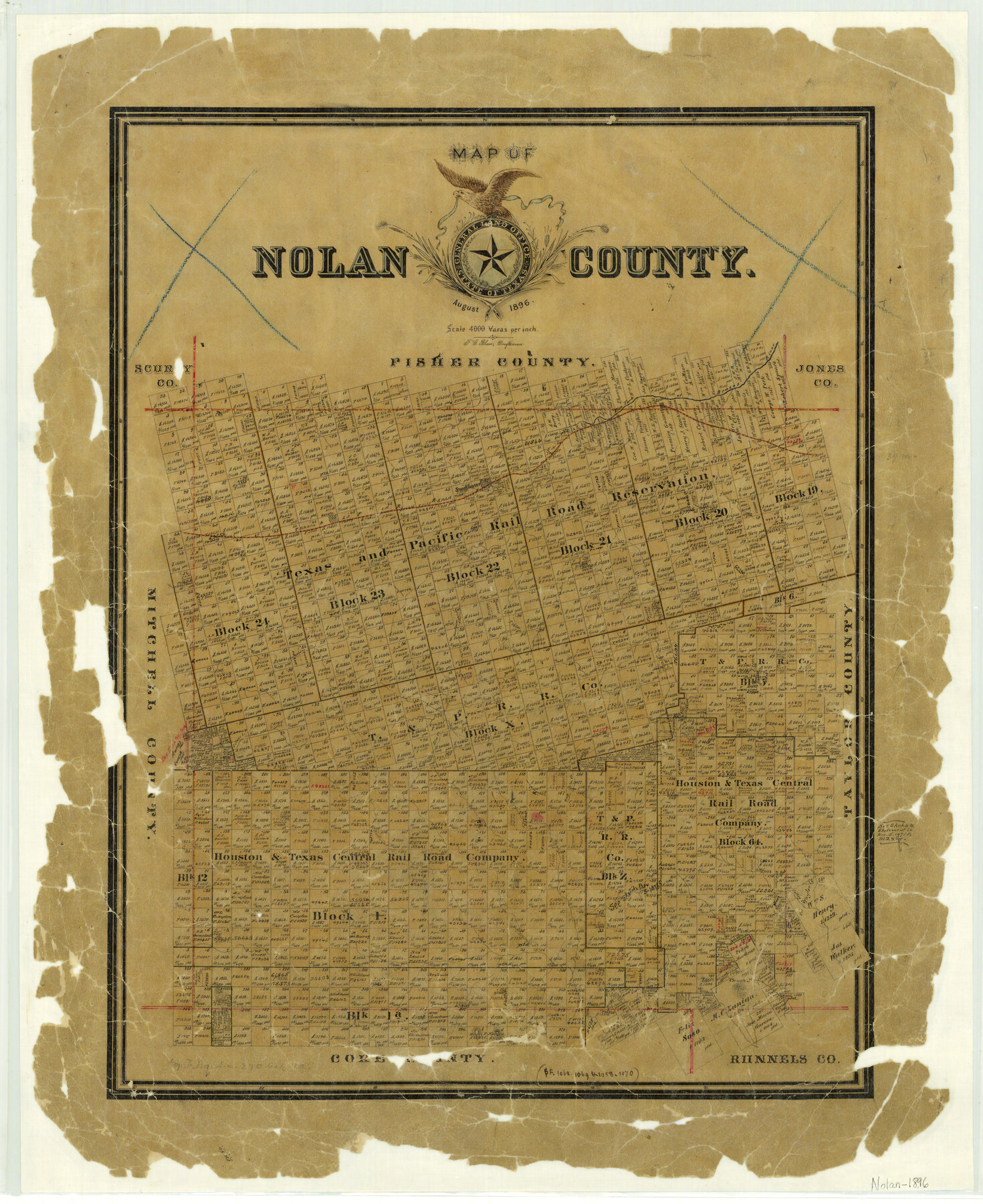
1896 (Creation Date) Map features Elm Fork of Brazos River, Valley Creek, McKinney’s Creek, Escota [sic], Sweetwater, T&P, Katula, Sweetwater Creek & more.
Texas General Land Office (Publisher)
F.G. Blau (Draftsman)
F.G. Blau (Compiler)
Height x Width
28.8 x 23.5 inches
73.2 x 59.7 cm
For more information about our relationship with GLO Maps, please see our GLO Maps Disclaimer.


Reviews
There are no reviews yet