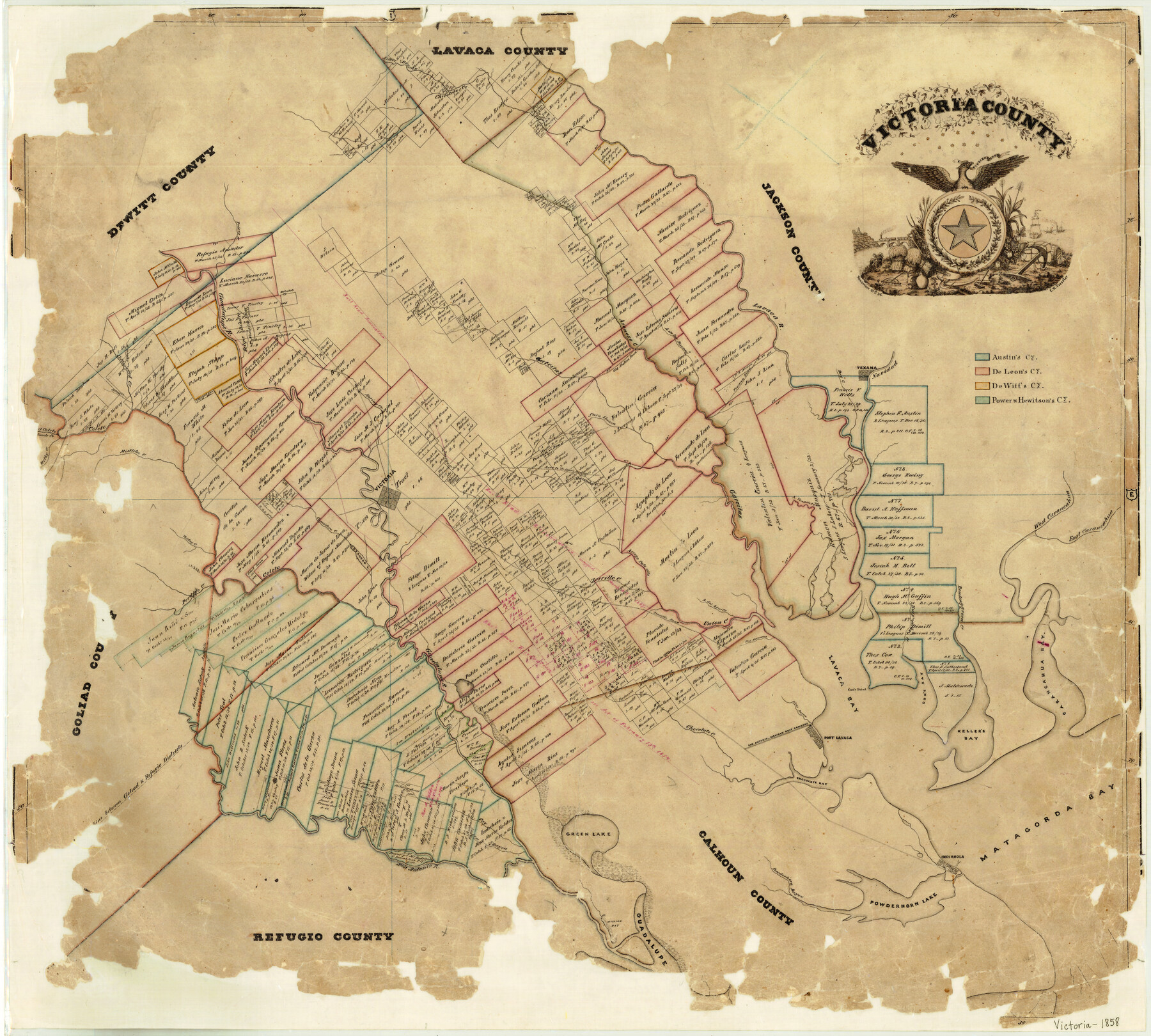
1858/11/21 (Creation Date) Map features Green Lake, Union Creek, A[rroyo] del Aguila, Trez [sic] Hermanos Creek, Huisache Creek, Bowling-green Creek, Carancahua Bay, Cox’s Bay, Cox’s Point, Lavaca Bay & more.
Texas General Land Office (Publisher)
Charles W. Pressler (Draftsman)
Charles W. Pressler (Compiler)
Height x Width
26.5 x 29.2 inches
67.3 x 74.2 cm
For more information about our relationship with GLO Maps, please see our GLO Maps Disclaimer.


Reviews
There are no reviews yet