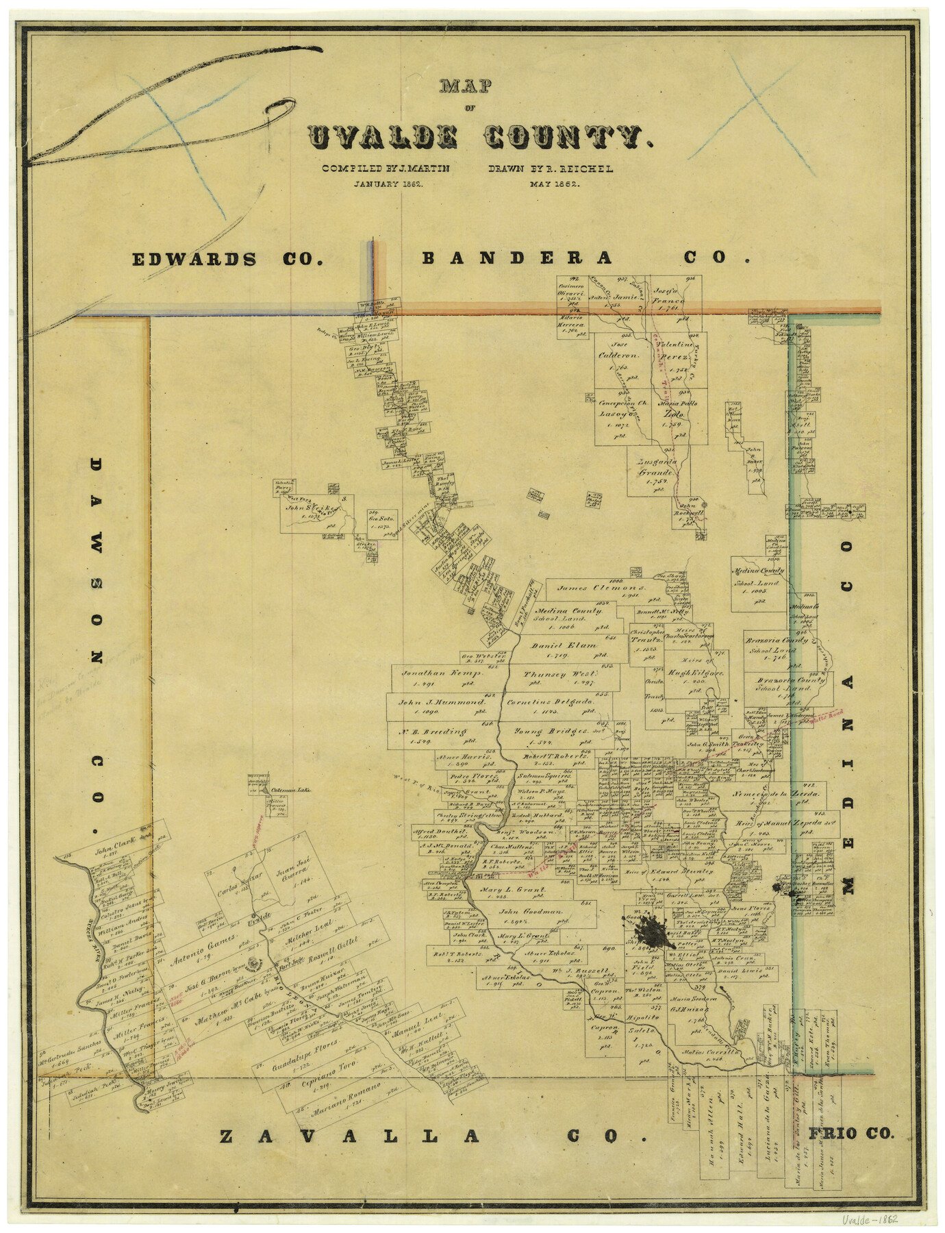
5/1862 (Creation Date) Map features Coleman Lake, Rio Frio, Indian Creek, Rio Leona, Kendalls Creek, Pecan Creek, Fort Inge, Leona Mount, Uvalde & more.
Texas General Land Office (Publisher)
Robert Reichel (Draftsman)
Joseph Martin (Compiler)
Height x Width
27.4 x 20.7 inches
69.6 x 52.6 cm
For more information about our relationship with GLO Maps, please see our GLO Maps Disclaimer.


Reviews
There are no reviews yet