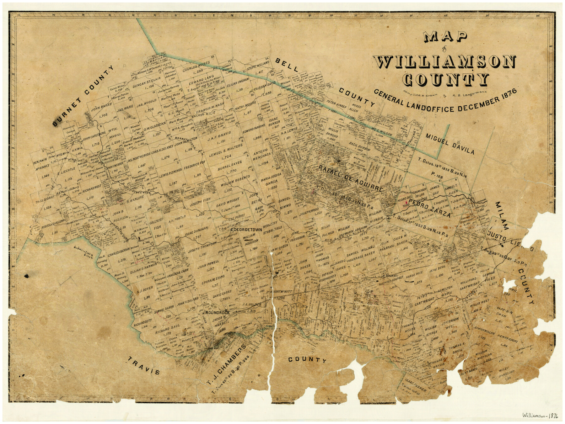
12/1876 (Creation Date) Map features South Fork of San Gabriel River, Round Rock Station, Mustang Creek, Dry Fork [of Brushy Creek], Pilot Knob, Lake Creek, Round Rock, Hutto & more.
Texas General Land Office (Publisher)
A.B. Langermann (Draftsman)
A.B. Langermann (Compiler)
Height x Width
21.2 x 28.6 inches
53.9 x 72.6 cm
For more information about our relationship with GLO Maps, please see our GLO Maps Disclaimer.


Reviews
There are no reviews yet