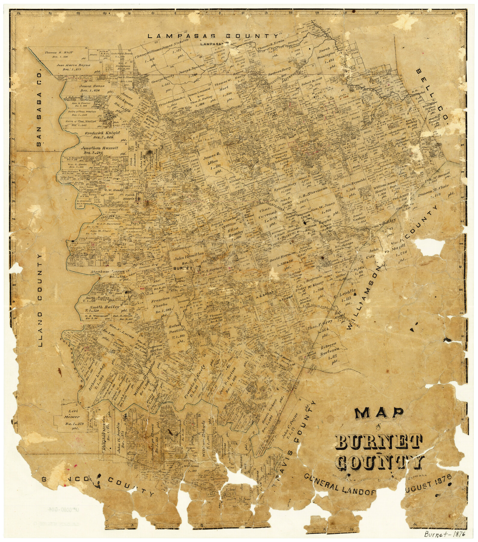
1876 (Creation Date) Map features Colorado River, Websters Creek, Backbone Valley Road, Honey Creek, Hamilton Creek, Hairston Creek, South Fork of San Gabriel River, East Fork of Backbone Creek & more.
Texas General Land Office (Publisher)
A.B. Langermann (Draftsman)
A.B. Langermann (Compiler)
Height x Width
24.5 x 21.3 inches
62.2 x 54.1 cm
For more information about our relationship with GLO Maps, please see our GLO Maps Disclaimer.


Reviews
There are no reviews yet